Laurel Woods Trail
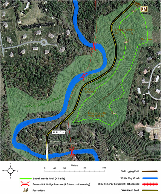

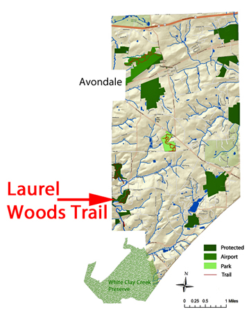
The Laurel Woods Trail (identified by the arrow in the above township map) is located on the former Phelps property
one mile north of Landenberg. The trail is accessible from a public right-of-way off of Laurel Heights Road. The trail is 0.9 miles long with approximately
200 feet of total climbing. Highlights include rare patches of Mountain Laurel, native holly trees and native flowers. There is a platform at the southern
end of the trail overlooking the man-made rocky cut for the abandoned Pomeroy and Newark Railroad.
An interpretive sign provides
details about its history.
Click the to view photographs taken on the trail.
Click the
to view photographs taken on the trail.
Interactive Map of Laurel Woods Trail