Mill Race Trail

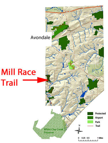
The Mill Race Trail (identified by the red area in the
above map) is located along the western side of the Township adjacent to Franklin Township. Completed October 2011.
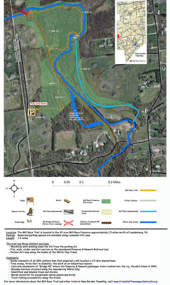
One and a quarter mile in length the trail meanders mostly along a flat path along the banks of the White Clay Creek. Part of the trail follows the abandoned Pomeroy and Newark Railroad bed which offers a gentle wide path for walking or running. At the northern end, the trail curves off the railroad bed and loops around the inside of a wide bend in the creek. It passes a tree stump, 3’ in diameter, which a beaver toppled and skirts an old dam used to power a mill a mile downstream. The trail is packed dirt along the creek and a mix of cinders and dirt on the railroad bed. Access to the trail is from a small parking area along Lavender Hill Lane (west side).
The path takes you to two historical features, site of the train wreck located on “Bridge 42” and the remaining stones from the former mill dam which diverted water from the White Clay creek to a man made race that transported water one mile down to a mill. The energy delivered to the mill was the equivalent of two horses. In the future, interpretative signs will be placed at these two locations describing then in detail and images.
A natural preserve area know for its rich bio diversity of plants and animals is adjacent to the trail. Information about this preserve and other preserves can be found in the Township’s 2010 Botanical Survey.
To volunteer to help maintain the construction of the Mill Race Tail please contact
Friendsofthetrail@aol.com.
Interactive Map of Mill Race Trail
